Santiago Trip – April 18th, 2009

dsc05059 Well, I was up at 6:00am to meet Chris and Brian in Lake Forest at 7am.  We started up via Maple Springs Road at 8am, and it was a nice drive.  The road was in good condition, and I always forget how long the road goes until the pavement ends. I also forget the smell of being outdoors.  I’m not sure if it’s all the sagebrush, but it just makes me breathe easier.  It’s hard to believe that I am still in Southern California when I’m traveling these mountains.

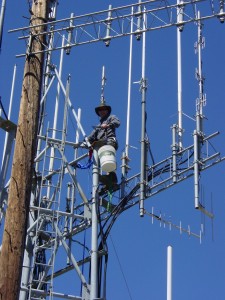
Here I am on top of the tower after lowering an antenna down.  We switched it out for a different antenna and redid the receive system.  It seems that the repeater is working better.  I know the transmit power has less reflected (50W forward, 1/2W reflected), and the receive is  a little more sensitive — it works better with a handheld.

The next picture is a pullback of the building and shows the layout.  The tower is a couple of stories tall, and this day it was bug free up there.
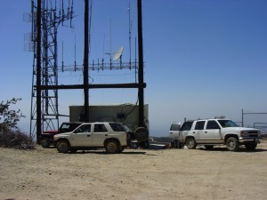
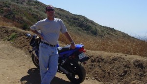
dsc05069That was not the case on the ground. I thought that it would be too cold, but I was wrong.  It was the busiest  I have ever seen on Santiago, both with the bugs and people.  I don’t know how many hikers, bikers, and joyriders there were.  When I was up on the tower, a motorcycle rider came up, got off his bike, and asked for Dan.  “What? Was that ITD?”  Yup, it sure was.  I have not seen Eric Robitaille for about 10 years! And now were talking on the top of Santiago.  Weird.  There was also a rescue going on to the north about 6 miles away on Skyline Road of a body in a car over the side.  While that was going on, a guy rolls up in a pickup to the emergency crew saying he just got bit by a rattlesnake.  There was a lot of coordination trying to figure out if they could helicopter the guy out.  I never found out how things ended.  When stuff happens, it happens.

How to increase gas milage

For a few years now before green was the thing, I’ve had this idea.  It seems kind of obvious to me, and I’m a bit puzzled why it has not happened.  See, the real solution for increasing vehicle MPG is not with the vehicle, it’s with the system. By my tracking for over 5 years (another topic for another post), my 4WD Isuzu Rodeo gets about 13 MPG in the city, and 22 MPG on the highway. Most cars are like that.  Our Toyota Sienna gets around 16 MPG city and 22 MPG highway (3 years worth of data).

The thing that really kills the MPG is stoplights.  You waste all the energy slowing down, then dump all the gas accelerating back up to the speed limit, where you hit another red light and the cycle repeats.  What’s really needed is a way to give the driver some feedback on what the optimum speed is to make the next green light.

So here’s how it works.  You cannot really change the stoplights — it just costs too much to synchronize them.  Sure it can be done, but then you have to squabble over city borders, etc. What you do is add a device to the existing signals.  So here goes.

The invention consists of the Monitoring Segment and the User Segment.  The Monitoring Segment consists of devices that are installed in existing stoplights that ideally interface with the signal timers and contain GPS receivers.  They are configured to know their nearest neighbor stoplights, the contact information for these stoplights, and the distance to those neighbor stoplights. They transmit their own timing information, and also the nearest neighbor contact information and distance.

By using CDMA technology, you can create efficient frequency reusage.  Heck, the whole thing could probably be implemented without any FCC registrations by using 802.11 or some ISM band. The important part is that by using a CDMA architecture, you can have low powered local signals that overlay eachother, streaming the contact information (code) for the next signal. To everyone else, including the incumbent user, there’s a higher noise floor.

The user segment is implemented as a receiver in the car.  This could be a built-in device, or an aftermarket add-on;  think GPS navigation device.  It  should have a GPS receiver anyway, as the car needs to know where it is in relation to the approaching stoplight.  The basic jist is that the car scans for a stoplight RF signal, locks when found, and begins to build a table of neighbors. As the car travels the city, it is picking up timing information for the next stoplight, and is far enough for the stoplight to transmit its timing information to the approaching vehicle.  By using the timing information and distance from the stoplight, the device can display the optimum speed that is necessary to make the next green light.

So there. If you do make a device, all I ask is that you send a receiver to me so I don’t have to think about these things while sitting at a red light.

And it’s not my fault my MPG is lousy.  See, the improvement has to come from the system side.  The government has to solve the problem. Heck, the have an obligation to solve this problem.  It’s probably cheaper than synchronization.

Another Long Ride

Back in Oct 2008 I took a business trip on my 2003 Yamaha YZF-600.

dsc04688

It was about a 400 mile round trip that started out at 7am and ended at 11:00pm with about 3 hour rides inside both ends.  I was trying to see how things would fair on a 600cc class street bike, and whether or not a long distance trip would be possible.

I remember for about 2 weeks after that my hands were just constantly numb and my fingers tingling.  I thought it was from the vibration — you kind of have that feeling in the feet when you go on a long ride, say 30 miles at a time.  However, this tingling just kept on going for days.

After doing some seaching, it appeared that I was just gripping the handlebars too tightly.  So I was interested in doing a long distance ride again, trying to stay loose and remain relaxed in the arms and hands.

So yesterday was the day.  Another 400 mile round trip, this time on my terms.  I started off at about 9am, cranked out 200 miles, and then arrived at my destination for a couple hours of work.  I didn’t seem to have any problems with my feet or hands.  In fact, the only problem was my skrunched legs. I started back on the road at 2pm and took the back way through Buellton, Solvang (I’m not a fan), and then stopped at the Gainey Vineyard (I am a fan) to pick up a couple bottles of wine.  Picked up highway 154 east past Lake Cachuma, back over the hills to Santa Barbara, then continued home. Today all is fine, except for some sore inner thighs — lots of peg weighting and tank pushing with the legs. But the good news: no hand tingling at all!

FEMA Training Online

This is a mental note for me. For RACES (Radio Amateur Civil Emergency Service) and EOC (Emergency Operations Center) training, take the FEMA IS-100, IS-200, and IS-700 courses available at ISP Courses. This is a introduction to the Incident Command System and such. It might even be more, but I have not taken the training yet.

Santiago Peak Benchmark Survey Marker

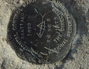
dsc02013So here it is — the official point where the Riverside and Orange Counties touch at Santiago Peak. I don’t know why I like this picture.  It tells a story that we’ll never know. I mean, “How did all those marks get there?”  It seems like 1899 would be a long time to be up there, but then there are the scar marks to prove it.
Front Yard Finished

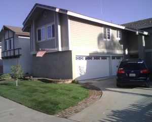
Front YardWell, I finally got the sod in.  This picture was taken Dec 5, 2008. It’s Marathon II.
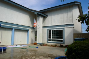
The lower picture is from July 24, 2005, and gives an idea of what the house looked like before the addition.
dsc_0021